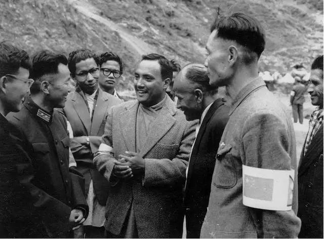
Zhang Ming, the Historical Witness of China-Nepal Boundary Exploration
Originally published in 2019-08-01
Editor's note: On August 1, 1955, China and Nepal, as friendly neighbors, formally established diplomatic relations. On the occasion of the 64th anniversary of the establishment of diplomatic relations between China and Nepal, the zǔguó wǎng1 website specially published an article on the memories of the old Tibetan descendants who visited the border between China and Nepal.
In October 1959, when a Nepali visitor asked Premier Zhou Enlai about the Chinese government's position on the settlement of the land boundary between China and Nepal, he said, "...in order to show the friendship between China and Nepal and set an example in Asia, as agreed by the Nepali government, we are ready to immediately start negotiations on the boundary issue and demarcate the boundary after survey."
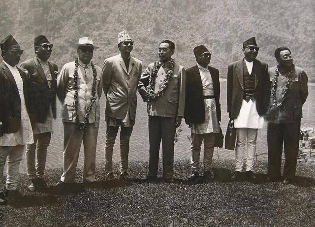
On March 21, 1960, Premier Zhou Enlai and B.P. Koirala, plenipotentiary representative of the Government of His Majesty the King of Nepal, signed the “Agreement between the Government of the People's Republic of China and the Government of his Majesty the King of Nepal on The Boundary Issue between the Two Countries” (The Boundary Agreement) in Beijing. The Boundary Agreement stipulates that the entire boundary between China and Nepal shall be drawn scientifically and demarcated formally on the basis of the existing traditional customary lines through friendly consultations. The contracting parties decide to establish a Joint Commission on the Boundary between China and Nepal, composed of the same number of representatives of the two sides at the same level and instruct the Commission to negotiate and settle specific issues related to the boundary between China and Nepal, survey the boundary, erect boundary markers and draft boundary treaties in accordance with the provisions of Article 3 of this Agreement.
Lens, photos, and diaries pull out the precious past
On August 11, 1960, the China-Nepal Joint Boundary Committee was established, consisting of the People's Government of the Tibet Autonomous Region, the Tibet Military District, and the State Administration of Surveying and Mapping.
My father, Zhang Ming, was the head of the Political Department of the Tibet Military District at the time. From 1960 to 1963, he participated in and witnessed the whole process of the border survey between China and Nepal.
In the early 1960s, I heard my sister describe a news bulletin that showed my father laying earth for a monument on the mountainous border between China and Nepal. I also heard from my mother that my father had taken part in the border survey between the two countries. In an old suitcase at home, the old photos of my father during the Sino-Nepali border survey are still glowing with old colors, and my father’s work diary has recorded the status of the Sino-Nepali border survey in detail. Over the decades, all of this has drawn in me a feeling of affection and longing for inquiry, which is why I started to follow the map and search everywhere for more clues. The footprints of my father on the Sino-Nepali border finally became clear.
On November 19, 1960, the list of main personnel of the joint survey team of the China-Nepal Boundary Committee of the Rasuwa Bridge (Miteri Bridge), recorded by my father in the work diary: Chinese representative Zhang Baohua, team leader Lieutenant Colonel Zhang Ming, deputy team leader Zhang Zuji, and guard captain Major Sheng Yongshen, technical directors Yan Xinguang, Zhou Jiqing, Tian Rongzheng, secretary Lu Jinghua, liaison officer Lieutenant Jiang Fuyi. The representative of the Nepali side was Major Aditya Shamsher, the team leader Lieutenant Colonel Pashupati Shamsher, the deputy team leader Lieutenant Sachit, the technical officers 阿尔琴(ā'ěrqín) Alchen Bahadur Basnet, 戈那(gē nà) Gona Niti Nepali, 哈里曼 (hālǐ màn) Sub-Technical Officer Hariman, Tibetan Translator Pubu.
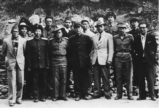
On November 20, 1960, the Sino-Nepali Boundary Joint Committee's joint survey team for the Rasuwa Bridge (Miteri Bridge) set off from Lhasa to Gyirong County, which belongs to Xigatse.
Since 1960, China and Nepal have conducted surveys on the boundary line in their respective territories, aiming to provide information on transportation, accommodation, climate, hydrology, geography, humanities, and public security for subsequent boundary surveys.
My father and his comrades were working on the borderline with an average altitude of 4,000 meters, unable to hear from my mother who was working in Lhasa, let alone their four children in Chengdu. Zhu Qixi, then assistant of the Logistics Department of Tibet Military District and later director of 78 Hospital, searched for memories hidden deep in his mind: the working place of border survey was very remote, with mountains, dense forests and rapids, rugged and dangerous roads, and very few people. Snow pigs, grey monkeys, hares, and even snakes and scorpions haunted the camp. The working conditions and living conditions of the demarcation workers were also extremely difficult. The Chinese demarcation workers were all equal, living in makeshift tents and eating the same food every day: dehydrated vegetables, canned food, and rice. Sometimes dehydrated dishes and other non-staple foods were unavailable, so they had to eat chili and rice. On rest days, everyone would go up the mountain to find fuel, collect cow dung, collect dry wood, and cut grass. In contrast, the Nepalese officials in the demarcation of the boundary are of distinct ranks, each with a porter, and a special person is required to escort them when crossing the river.
On New Year's Eve in 1961, the mountain where the Chinese demarcation personnel was stationed was covered with snow, leaving a vast expanse of white. My father organized a small gathering for everyone, and took the lead in reciting Mao Zedong's poem "Snow Adopted After the Tune of Chin Yuan Chun", in order to gather warmth, inspire the fighting spirit within them, and also reflect his philosophical attitude towards life.
Soon after, my father was instructed to return to Lhasa to welcome the team.
Negotiations, differences, friendships, and the defense of territorial integrity
In April 1961, the spring breeze gently brushed the face of the ancient city of the plateau. The government of the Tibet Autonomous Region and the Tibet Military District held a grand meeting in the auditorium of the military region to welcome the Sino-Nepal border joint survey team. The Chinese demarcation team shouldered the glorious and arduous task. They were divided into five survey teams and took Jiefang brand cars to embark on a long journey to the destination of demarcation work.
On May 8, 1961, my father recorded in his work diary the list of Chinese personnel of the fifth joint survey team of the Sino-Nepali Border Joint Commission: team leader Luo Shisheng, deputy team leader Zhang Ming, deputy team leader (and technical director) Shi Zhizhi, clerk Zhu Zhenqi, secretary Chen Ruilue, guard captain Wang Jianying, team leader Lei Baotao, the second team leader Yang Shixi, the third team leader Wu Dong, the fourth team leader Li Jia, the astronomical team leader Sun Jingan, and the liaison officer Chang Kaizhong, Photojournalist Zhao Minjun, etc. List of Nepalese personnel included: Lieutenant Colonel 古·巴卡尔基 (Gǔ·bā kǎ'ěr jī), Deputy Team Leader Captain 阿纳·那 (Ā nà·nà), Prospector 布·拉托 (Bù·lā tuō), Deputy Prospector 布·拉托哈·欧姆塔 (Bù·lā tuō hā·ōumǔ tǎ), Liaison Officer K. Prashant, guard Captain 基·开托里(Jī·kāi tuō lǐ), Translator 铁·巴哈杜尔 (Tiě·bā hā dù ěr), etc.
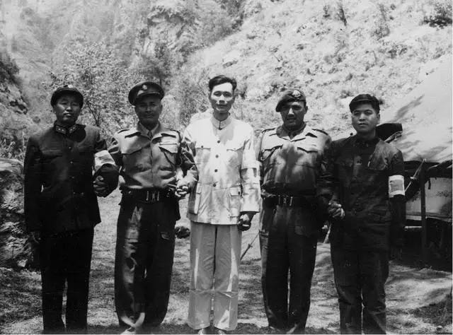
My father accompanied the fifth survey team, after several days of bumpy cars, passed through Xigatse and Gyantse, and went to the designated location in our country at the junction of China—Nepal, and Sikkim. At this point, the highway came to an end and it takes at least two days to walk to reach the work site of Jimatang. My father and his comrades were wrapped in dust and fatigue all the way and camped under the Himalayas. The next day, the members of the survey team, carrying all the equipment and daily necessities, traveled westward along the Himalayan ridge and began to cross the Korala Pass, which is 5,500 meters above sea level.
When climbing the mountain, the altitude showed a three-dimensional rise, resulting in an extremely difficult walk, headache, chest tightness, shortness of breath, and painful tearing in the respiratory tract. My father and the survey and mapping technician Li Zhenxue were the first to reach the top of the mountain. On the third day, the survey team continued their march, headed down the mountain, crossed a single-plank bridge, and when the sun slanted westward, the mountain stream and valley mist rose, which was when the team finally reached the base of Jimatang. The side of Jimatang is bounded by the river, the east of the river is in China, and the west of the river is in Nepal. The Nepalese demarcation personnel also arrived at their destination on time. Following the traditional borderline, the two sides were separated by 100 meters, where they pitched tents, built workshops, and set up camps in their respective countries.
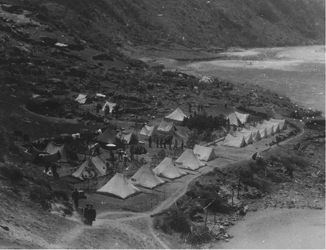
The "Boundary Agreement" stipulates the method for China and Nepal to determine the border between the two countries: the areas on the maps of the two sides that correspond to the boundary between the two countries; The actual jurisdiction of the two sides is an undisputed territory, although the boundary line shown on the maps of the two countries does not match; Maps of the two sides show areas where the border does not match and where the two sides have different perceptions of what is actually under their jurisdiction.
During my father's investigation of the Sino-Nepali border, a lot of work was involved in negotiating the border between the two sides. In general, China and Nepal conducted negotiations at the time and place agreed by the foreign affairs departments of the two countries, and temporary negotiations were added depending on the actual situation of demarcation work. The talks were centered on the ownership of Mount Qomolangma, the main peak of the Himalayas, as well as a number of mountains’ passes along the border between the two countries. My father recorded in his work diary that during negotiations, on the basis of adhering to the principles of equality, mutual benefit, friendship, and mutual accommodation, we should defend national interests at all costs and ensure the territorial integrity of the motherland. Negotiations were tough, as can be seen from my father's work diary. China and Nepal have often repeatedly discussed and even entangled in the specific matters of the survey, making matters difficult to decide. Once, a Nepalese representative used the biscuits on the negotiating table as an analogy to bargain with my father, saying that reclaiming an extra piece of land was like asking for extra biscuits, which would not affect the overall situation. With national interests in mind, my father combined adherence to the relevant negotiation agreements and guidelines with the promotion of the Sino-Nepali friendship. He sought truth from facts, grasped the principle of justice, patiently persuaded Nepali officials, and finally settled the differences reasonably.
Yang Quanda, a member of the State Administration of Surveying and Mapping who participated in the Sino-Nepali boundary survey, recalled that the south side of the Korala Pass is surrounded by hills, and the north side is surrounded by snow-capped mountains and glaciers. A narrow grassy beach about 1,500 meters wide and several kilometers long was lying in the middle, and the melting of ice and snow had formed various gullies on the grassy beach. By convention, the centerline of the creek should be used to demarcate the boundary. Once, when a small stream less than 1 meter wide was drawn, because the Nepali border demarcation officials proposed to use the Chinese side of the ditch as the boundary, the two sides had differences and formed a deadlock. The Chinese side asked Premier Zhou Enlai for instructions on this matter. Premier Zhou replied to the telegram: No land will be given up, and the territorial integrity of our country will be guaranteed. The Chinese side strengthened communication and enhanced friendship by hosting a banquet with the Nepali side and holding social activities. The Nepali side finally retracted its unreasonable demands. In this way, in the days of getting along day and night, the border demarcation counterparts of China and Nepal got along friendly and forged a profound friendship.
Boundary markers, stakes, and monuments bear witness to the China-Nepal friendship
On October 5, 1961, Chinese President Liu Shaoqi and King Mahendra of Nepal signed the Boundary Treaty between the People's Republic of China and the Kingdom of Nepal (Boundary Treaty) in Beijing.
In 1962, after many negotiations and consultations, China and Nepal reached a consensus. Based on the maps drawn by the previous survey, the total length of the border between China and Nepal was 1414.88 kilometers, and the specific direction and location of the border between the two countries were determined. There were a total of 79 boundary markers and 98 boundary markers on the Nepalese borderline, as well as the establishment of boundary markers and boundary stakes on the spot.
My father recorded in his work diary that most of the survey and mapping work on the Border between China and Nepal was conducted by the Chinese side, while the Nepali side conducted the correction or participated in the survey. Li Zhen Xue, a surveying and mapping technician who took part in the China-Nepal boundary survey and now works for the senior Cadres Bureau of The Municipal Party Committee of Hejin, Shanxi Province, still remembers many details of the boundary survey and mapping. At that time, the Himalayan area was not connected with the national geodetic control network, so it was a blank area in the surveying and mapping industry and there was no reference for any data. There was neither GPS nor far-infrared ranging, and the survey work could only be carried out by astronomical measurement and barometric elevation measurement to determine the coordinates and elevation of the starting point, and then conduct baseline measurement and small triangulation measurement, and based on this encrypt the control points, and then complete the 1:100000 topographic map measurement with a large flat panel meter. The work of boundary survey was a field operation, the working conditions were simple, and there was sporadic harassment of rebels in the mountains and deep streams, where Li Zhenxue in the border mapping mission experienced a thrilling moment.
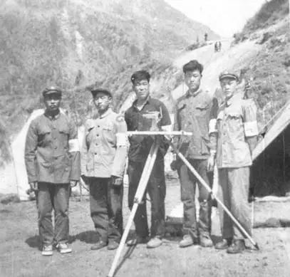
After arduous efforts, China and Nepal successfully completed the task of setting up boundary markers. On January 20, 1963, the Chinese Plenipotentiary, Vice Premier, and Minister of Foreign Affairs Chen Yi and Nepali Plenipotentiary Tulsi Giri signed the Protocol between the Government of the People's Republic of China and His Majesty's Government of the Kingdom of Nepal on the Boundary between the Two Countries ("Boundary Protocol") in Beijing. Hence, the border between China and Nepal was formally demarcated.
Memory is the rich ore of human civilization. Zhang Zuji, who was then the deputy director of the Boundary Office of the Foreign Affairs Office of the Tibet Autonomous Region, lived side by side with his father for 3 years in boundary demarcation and shared a tent. To this day, he has never forgotten his father's humor; how he would leave a little beef to give to the survey barrack Xiao Lizi; the echoing laughter at the New Year's Eve Gala remained in Zhu Qixi's memory for many years; how my father opened and closed at the negotiating table and talked in an eloquent manner; my father's affection for Zhang Luo, a Tibetan compatriot in the locality. After several months of searching and interviewing the involved people, I recalled my father's years in the Sino-Nepali border survey through them. It was like flipping through pictures, vividly sketching out my father's work and life when he participated in the Sino-Nepali border survey more than 50 years ago, which moved me by his experiences.
Youth always passes, and fame is like catkins in the wind, erratic2. In 1938, my father joined the Fourth Division of the New Fourth Army and went to the front line of the Second Sino-Japanese War for the sake of my country and the nation. My father followed the 18th Army into Tibet in 1950 and was transferred to the Chengdu Military Region in 1970. In these 20 years, he grew, accumulated, and even harbored a deep affection for the snowy plateau and the Tibetan compatriots who recuperate there. Spiritual sustenance and life remembrance. My father always advocated the behavior of a gentleman, self-cultivation in peace, and cultivated morality through frugality. My father treated his past indifferently and never wanted to write memoirs.
On May 9, 2014, my 94-year-old father passed away, as peaceful, and as calm as he was before his death.
The album of history records the work that my father took part in half a century ago. During the 3-year Sino-Nepali border survey, my father, and his comrades in arms lived up to their mission. Within the mountains and rivers of the two districts and seven counties of Xigatse, the Sino-Nepali borderline of more than 1,400 kilometers was drawn with sincerity and responsibility to the motherland.
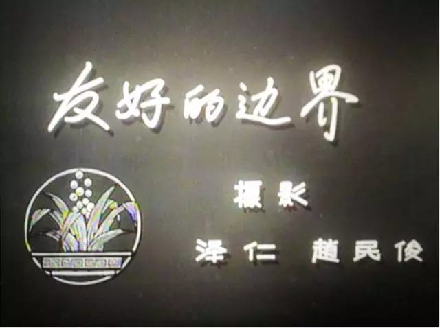
In October 1961, the Central News Film Studio completed filming the documentary "Friendly Borders", which recorded the memory of the China-Nepal border survey with precious images, and also narrated the past events of my father Zhang Ming in Tibet.
(Author Zhang Yiping (daughter of Zhang Ming) authorized this article to be published on the motherland website of the "Motherland" magazine. If reproduced, please indicate the source.)
The link to the original article can be found here.
Our Note: there are Nepali names that have been lost in translation. Kindly requesting anyone familiar with the names to comment in the piece with some description.
Zǔguó wǎng (祖国网)is a news website reporting on current politics, finance and economics, military, culture, society, patriotism, history, international, commentary, tourism, health, local, and pictures with a focus on reform and society.
Tentative translation of “鬓底青春留不住,功名薄似风前絮” extracted by the author from Mao Pang’s "Fisherman's Pride" (Song Dynasty)


